Introduction
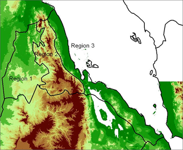
Eritrea is a malaria epidemic-prone country in the horn of Africa. It is divided into three main topographical regions—the western lowlands, central highlands, and eastern coastal lowlands—with different rainfall seasonality patterns (Figure 1). There are six administrative regions ( zobas ) with 58 districts ( subzobas ) and approximately 1,500 villages. The estimated population is 3.5 million.

Figure 1 - Eritrea map showing the topography of the country with three regions: Region 1 is characterized by lowlands, Region 2 is characterized by a mountainous area, and Region 3 is characterized by a lowland area on the Red Sea coast.
