Satellite derived estimates of vegetation "greenness"
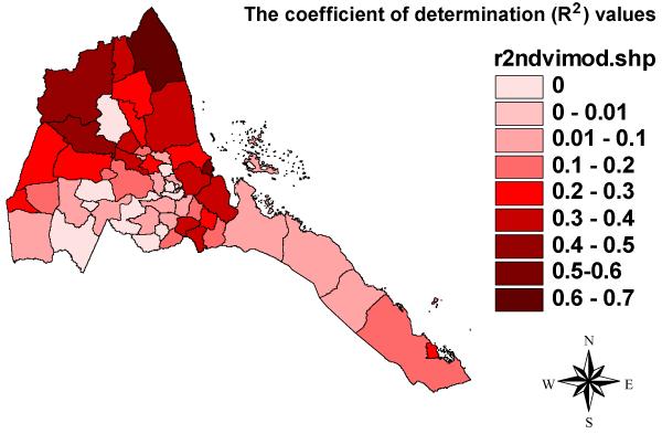
NDVI anomalies are well correlated with malaria incidence anomalies, particularly in the semi-arid north of the country and along the coast in Northern Red Sea (Figure 6). Areas of high correlation are largely those identified as ‘sparse vegetation’ from the Africover land cover map produced by the Food and Agriculture Organization of the United Nations. An advantage of NDVI over rainfall is that it is indicative of soil moisture and is therefore capable of picking out areas where rainfall runoff may have a significant impact on malaria transmission.

Figure 6 - Relationship between NDVI and malaria anomalies. The coefficient of determination (R2) values indicates the proportion of variability in the malaria anomalies that is accounted for by the NDVI.
